Home Price Summary Contact Us
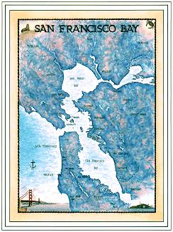
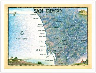
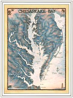
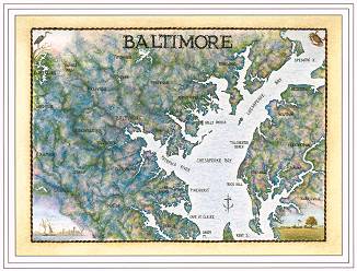
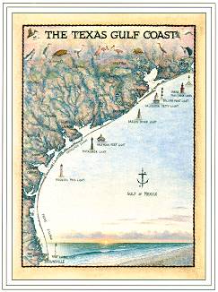
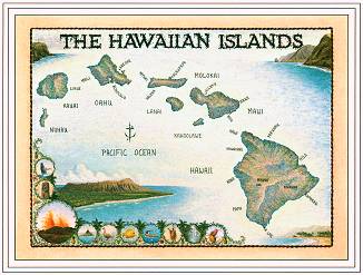
In 1989 artist Terry Moore set out on a "mission" to do what has never been done in the history of our great nation. His goal was to create a series of artistic-maps (geographic/ or geo-art) that would encompass all of America's spectacular coastlines. From Alaska to Maine, Hawaii to the Great Lakes, throughout the East, West, and Gulf Coasts, the "Waterways Collection" is doing just that. Today, with almost 95% of America's Coasts covered and an array of future projects underway, the Collection is "ever growing and ever going" towards the fulfillment of that vision. By doing all his own research and interviews, adding corner vignettes to each piece, and composing a poem or narrative specifically for every location, Terry has sought to bring a personal vision back into the world of maps that has long been absent. From its inception, he's felt the real challenge in creating a collection of this nature would be to connect people, not with "point A" or "point B" like functional maps, but instead to connect them with something far more significant, their memories! "Mapping Memories" has become a theme of this work and has served as a constant source of motivation to the ever-unfolding series. During his many signings and travels, people throughout the country have continuously shared their personal stories with him. These wonderful anecdotes have proven to be not only heartwarming and informative but a real source of on-going inspiration. They have become a treasured part of what this collection has come to mean to all of us at Nautical Hangups and Moore Art Inc.
(Most frequently asked questions about the "Waterways Collection")
| 1. WHY ARTISTIC
MAPS? As a devotee of history and art I realized that a void existed between modern functional maps and the beautiful hand drawn maps of the past. With a background in historical research methods and nine years experience as a color consultant and commercial artist, I set out (inspired by my wife, Jane, and dear friend,Carol - Yagottadoit - Baumann,) to create a series of works that would artistically bridge that gap. The result has been an ever-evolving "mission" that's become known as the "Waterways Collection". It now encompasses prints, notecards, shirts, full tapestry throws and other items from almost fifty of our nation's most beautiful coastal areas. |
 |
 |
2. ARE THE (MAP)
ORIGINALS FOR SALE ? Until recently, the originals have been held with the hope that as the scope and notability of the"Waterways Collection" grows, their true worth will lie in what they can give back to the communities that have contributed so much to the fulfillment of our dreams. Now reaching the completion of the Collection, for the first time, we are offering these originals for sale. With each sale, a contribution will be made to a children's charity from that area. |
| 3. WHY A POEM ? As a guitarist and lutenist, my love of music and rhythms naturally carries over into the love of language and its natural cadences. I hope that by including a simple (and heartfelt) poem on each map I can give people that little extra connection with the area and, perhaps in some small way, spark an interest or touch a heart. The poems often contain historical references and hints of the local lore along with some personal feelings about the area. |
 |
 |
4. WHAT ABOUT THE
RABBIT ? Since the first print, The Cape Fear, was released in September, 1989 I have hidden a RABBIT in my works. This served a dual purpose; the first being that in many ancient cultures RABBITS were considered lucky so I adopted it as my personal "reminder" of how lucky I was to be doing something I so loved. The second reason was that, I hoped it would bring some of the same to all those who believed in my artwork and this dream. My original intent was to keep this secret, but eventually people began to discover them until - now its not unusual to get a call from someone in Alaska asking, "what about that rabbit" ? |
| 5. HOW ARE AREAS
CHOSEN ? When the series first began it was conceived as a regional project that would group specific sections of the coast, such as the "Southern Waterways" into collections by themselves. It didn't take long however to realize that the lure and unbounded beauty of all our nation's spectacular coastlines belonged together in one collection. We have since discovered that this is the first time in the history of our nation that such an series has been undertaken by an artist. |
 |
 |
6. HOW IS THE
RESEARCH DONE ? The process always begins with a trip to the library (and more and more a '"surf down the internet") where many hours are spent establishing background information and a general "feel" for the region. The next step usually involves a visit to the area itself, where reference photos are taken that will assist in the corner vignettes and much more specific research can be done into the local history and original spellings and titles for the "nooks and crannies" where the history and lore took place. |
| 7.
WHAT RESOURCE MATERIALS ARE USED IN DRAWING THE MAPS? The maps are always hand-drawn
using a combination of U.S.G.S. Topographic Maps, Landsat Satellite Images,
old N.O.A.A. and Bathymetric Charts , N.A.P.P. Aerial Photographs and
actual historical maps themselves when available. Some of the works may
involve as many as a dozen or more reference maps and the scale can range anywhere from 1:125,000 all the
way up to 1:2,500,000. |
 |
 |
8. WHEN LABELING
THE MAPS, WHAT CRITERIA IS USED TO ELIMINATE "OVER LABELING" ? Sometimes, on the high density population areas and the larger scale maps, it is necessary to limit the amount of names labeled so that the aesthetic beauty of the print is preserved. When possible, the older names and places are labeled first with the newer ones added as spacing allows. The main objective is to allow enough reference points so any place can be easily located without turning the map into one big label! |
| 9. WHAT PAINTING
AND PRINTING METHODS ARE USED ? The originals are all oil on canvas, using various glazing and scumbling techniques to achieve a multi-layered, textured look. The printing process is called offset four color lithography using acid free paper and the highest quality permanent (lightfast) inks. |
 |
 |
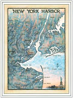
10. HOW LONG DOES
IT TAKE TO COMPLETE A MAP ? Depending on the scale and the topographical intricacies, the process usually takes approximately six to eight weeks ( note: this represents "artist-weeks" which entails a lot of twelve hour days). I do all the research, drawing and painting, hand labeling, and finally compose the as the final step prior to printing. (The only exception to this has been the New York Harbor print which contains the beautiful sonnet by Emma Lazarus). |